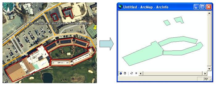
Google Earth is a 3D image viewer that provides free access to a rich resource of satellite imagery. Features can be digitized from the imagery and saved as a kml file. Kml files must be converted to a feature class (i.e. shapefile) before it can be used in ArcGIS. The KML to SHP tool converts the kml files, from Google Earth (version 4.2 or 4.3), to an ESRI shapefile. The shapefile retains the feature names and descriptions. The tool is run from ArcToolbox and requires ArcGIS 9.2 or 9.3.