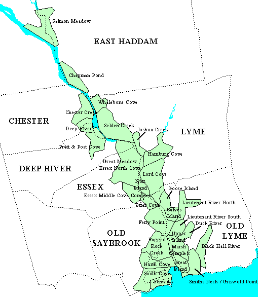
This page provides links to infomation about the areal extent of Phragmites australis in 1968 and 1994 within tidelands of the lower Connecticut River. To view a site, move the mouse over the index map below and click with the left button.
These data originally were prepared by Dr. Nels Barret (NRCS) and Sandy Prisloe (UConn) with funding support from the Connecticut Chapter of The Nature Conservancy and the Connecticut Department of Environmental Protection, Long Island Sound License Plate Fund.
Contact
Cary Chadwick
Geospatial Training Program Coordinator
cary.chadwick@uconn.edu
(860) 345-5216