Phragmites
australisis an aggressive invasive plant that has rapidly displaced natural marsh vegetation at many locations
within the tidelands region of the Connecticut River. A study conducted
by Dr. Nels Barrett, shown in the photo to the right, and Sandy Prisloe
mapped and quantified changes in P. australis distribution
in the Connecticut River tidelands between 1968 and 1994. Stands of P. australis are typically dense monocultures with well defined
edges. In the photo, Dr. Barrett is standing at the edge of the Phragmites
stand.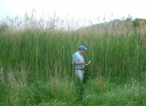
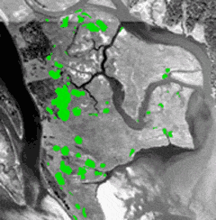
The images below depict the expansion of P. australis at Lord Cove, one of 32 inventory sites. For images of other inventory sites, click here.
 |
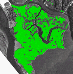 |
| 1968 areal extent of P. australis, shown in green, for a portion of Lord Cove (data courtesy of TNC) | 1994 increased areal extent of P. australis (data courtesy Conn. DEP) |
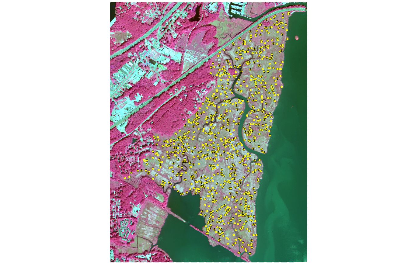
With the support of the CT Department of Environmental Protection Office of Long Island Sound Programs (OLISP) and funding from the LIS license plate fund, researchers including Bill Moorhead, Nels Barrett, Cary Chadwick and Sandy Prisloe conducted a year long study of Ragged Rock Creek tidal marsh. During the 2006 field season over 800 randomly selected 2 meter by 2 meter sites were inventoried and plant species, abundance, height and other characteristics were recorded. The data was used along with high resolution remote sensing imagery to classify the composition and spatial distribution of the marsh community. This research was published in 2008 in Remote Sensing of Environment. Click here to view the article.
The embedded map below highlight some of the major species found in Ragged Rock Creek tidal marsh. Click on a point to view a photo and description.
View Ragged Rock Creek Tidal Marsh Research in a larger map
Cheney Shreve, a Wesleyan University graduate student and recipient of a Connecticut Space Grant GeoSpatial Technology Program Fellowship, investigated sib-pixel classification techniques to measure the percent area of P. australis using moderate-resolution Landsat imagery. For more information about this research click here.
Contact
Cary Chadwick
Geospatial Training Program Coordinator
cary.chadwick@uconn.edu
(860) 345-5216
