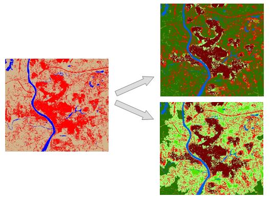
Urban development can impact natural resources by eliminating them through land use change and by degrading nearby natural areas. The pattern and density of development can affect the amount of land that is impacted. The Urban Landscape Analysis Tool (ULAT) is intended to classify developed areas of different densities as well as identify undeveloped lands that are likely to be degraded by close proximity to development. The tool can analyze land cover data for multiple time periods for a given city. For each time period, two maps will be generated showing the density classes of the built-up area and the undeveloped land degraded by proximity to the built-up area. In addition, the tool will classify the developement, that occurs between two consecutive time periods, based its proximity to previously existing development.
The tool requires the ArcView level of ArcGIS 9.3. The spatial analyst extension is required.